ChronoPoland
ChronoPoland - Interactive Map of Polish History
An interactive map of Polish history: one hundred outstanding figures, by era and field, over changing borders.
Web Application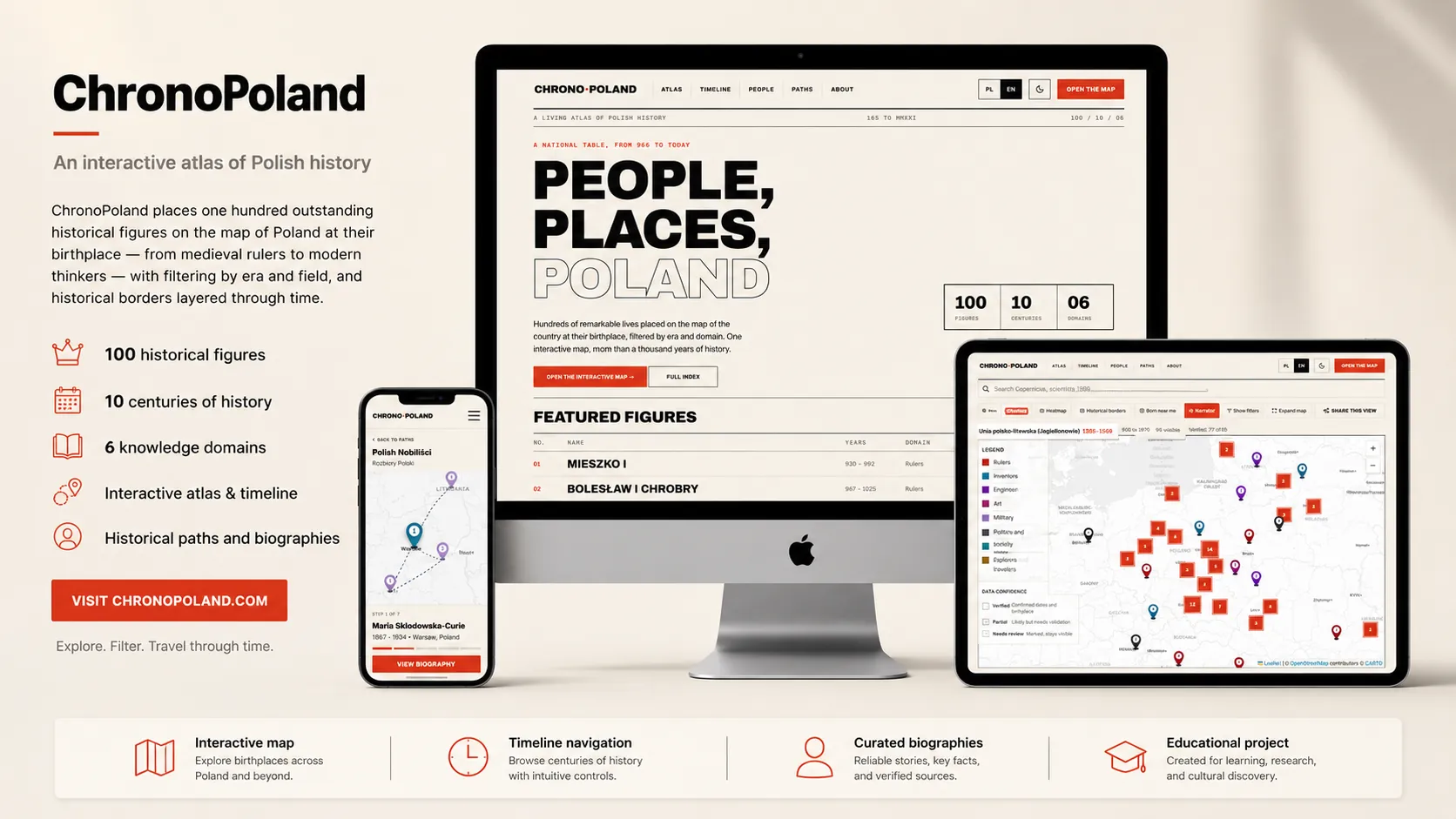
About
ChronoPoland is an interactive map of Polish history built around people and place. It pins one hundred outstanding figures, from medieval rulers to modern Nobel laureates, on a map of Poland at the place they were born, so a thousand years of history becomes something you can explore rather than read as a list.
Records can be filtered by era and by field, every entry links to its sources and carries a confidence rating (verified, partial or needs review), and the map is designed to overlay Poland's changing historical borders, so each figure can be seen in the territory of their own time.
The dataset is drawn from open knowledge, Wikidata, Wikipedia and Wikimedia Commons, with each person citing its own sources. The app is bilingual in Polish and English, requires no account and uses no third-party tracking.
Key Features
Interactive Map of Poland
One hundred historical figures pinned at their birthplace, with marker clustering and a density layer for exploring the whole country at a glance or zooming into a single region.
Filter by Era and Field
Narrow the map by time period and by discipline, rulers, scientists, artists, writers and more, to follow one thread through the centuries.
Historical Borders Overlay
An architecture built to layer Poland's changing borders across periods, so each person can be placed in the territory of their own era rather than on a modern map alone.
Sourced, Confidence-Rated Records
Every person links to its own sources and carries an honest confidence level, verified, partial or needs review, so the data never pretends to be more certain than it is.
Person Profiles
Each figure has a profile with a short description, era, field and direct links to Wikidata and Wikipedia for deeper reading.
Open-Data Foundation
Built on Wikidata (CC0), Wikipedia (CC BY-SA) and Wikimedia Commons, with a seed dataset that can be enriched from those sources.
Fast Search
Fuzzy, instant search across the whole dataset so any figure can be found by name in a couple of keystrokes.
Bilingual, Privacy-First
Full Polish and English interface, no account required and no third-party tracking, free to explore.
Privacy & Security
Your data stays on your device. Always.